
Hiking writer Harri Ahonen toured and compiled hundreds of hiking trails in Lapland. How familiar are Unarinköngäs, Sallivaara and Savilampi to you?
– At first I didn’t think anything of it, just looking for fells here and there. I looked in the direction of Finland and wondered if there were hiking trails in Finnish Lapland.
Although Ahonen has written numerous books on hiking, Finnish Lapland had yet to make it into the books.
When he got home, Ahonen emailed his cost manager.
– He said that it was about time to write about Lapland.
That started a process of several years, the end result of which was the opus Lapin tekkeilyreitit, published this spring. The creation process hit a snag, when camping in Lapland grew into a boom as a result of the corona pandemic. However, according to Ahonen, the interest in camping started even before the corona virus.
– People have noticed that moving in nature is simply good, and there are several studies on the subject.
For his book, Ahonen went through more than 250 different excursion routes either on foot or by bike. The time for the book and its groundwork was about two and a half years. The pace was tight, because the routes have to be covered during the thaw. It means that during one summer month, Ahonen had to transport around 25 day trip destinations.
– Yes, this camping is my job. You have to put the rucksack on your back, even if it’s raining and you don’t always feel like it.
However, Ahonen also admits that he enjoys his work, although, for example, transporting a long-tube system camera on a fast mountain bike route is not always very easy, according to the author.
And in the end, not all routes even ended up in the book.
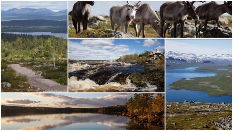
10 unknown but great destinations
The book still includes both well-known and slightly more unknown gems.
We compiled a list of 10 routes with less transport, but worth noting.
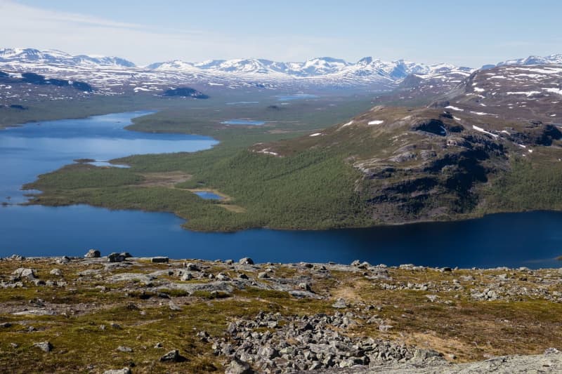
\”Inari is usually associated with the wilderness. If you want to see it concretely and at once, you should climb to the top of the Otsamo fell. There is no other place where such a landscape opens up at once.\”
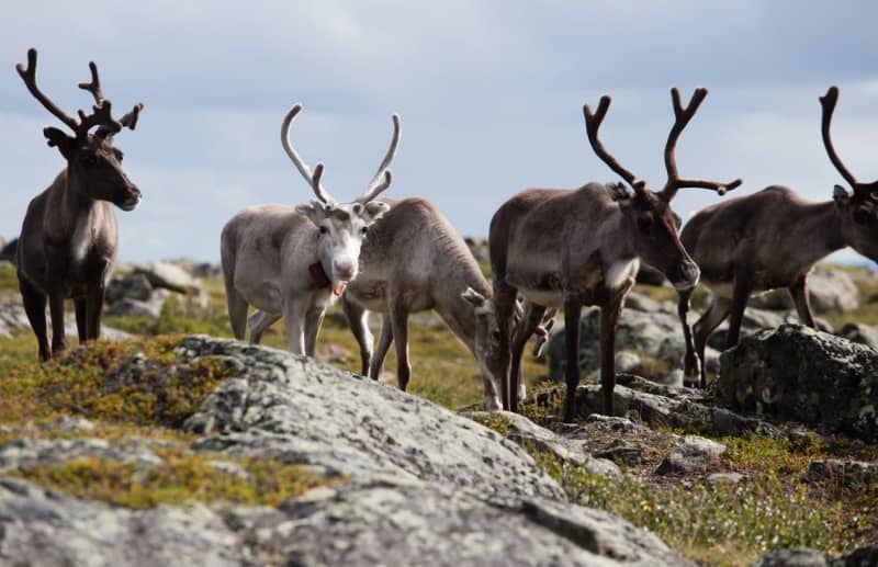
\”Sallivaara is a slightly longer wilderness sky. The round trip length of the entire route is approximately 14 kilometers. Vaara has a historic reindeer herding site and residential buildings that were in use. Of course, beautiful landscapes also open up from there.
\”When you go here, you have to pack your camera and note-taking equipment. This is a long and demanding mountain bike trail and it is not graveled, which is a good thing. There you will encounter a swamp and rocky cliffs that continue for kilometers. Despite the challenges, this is a great route, not all hiking always has to be so smooth. Of course, there is also one hut halfway there, where you can play the flute.\”
\”I remember how, as a brat, we used to go along forest paths and there were gorse and other lumps visible. This route has sometimes been like that too. Along the route you can see fairy tale ghosts, and it’s quite touching. There should be more of these and if they are built, they should also be taken care of. In Norway, it’s a joke that parents take their children to the fells every spring and leave in the fall. Even Finns could take their children to explore the trails with more courage.\”
\”Savilampi is part of the Oulanga National Park. You often don’t think that part of it can also be found in the area of \u200b\u200bSalla municipality. This is a rugged place and the canyon valley makes it unique.”
\”When we go to Utsjoki, we often go to Kevo. There is an easy route to the Laŋka hill, and the hill is only a little over 600 meters high. From the top there is still a limitless landscape towards Finland and Norway.\”
\”This is a pretty absolute place when talking about the Tenojoki valley. The whole landscape opens up from museum road. You can of course go in one direction even with a car, but on a bike it’s certainly easier to stop the movement and generally notice interesting places.\”
\”This route is challenging regardless of whether it is done by bike or on foot. You have to walk the last few hundred meters anyway. From here, the landscape reaches the majestic Kilpisjärvi, the great mountains of northern Sweden and northern Norway, and of course Saana from a completely different angle than they are usually photographed. And if you ask me, the views are much better from here.”
\”This is a sacred place for the Sami people, and you have to remember to be a gentleman there. I don’t know if you can call this a pious place, but at least it’s a place that defies sensitivity. And it’s not a long way to get here from, for example, Sallivaara, you can even combine the trips.\”
\”If you have thought about starting mountain biking, this is a good place to start. The route teaches that sometimes you have to carry the bike and sometimes you also have to put it on the boat and ride the bike with you for a while. At the end of the route, there is a thinly fenced passage where the frost has lifted the planks up and down. Cycling like that is its own art form, but you can also walk this route.\”
\”Saittajärvi is an accessible route. When you reach the starting point, it’s about 50 meters to the beach. Metsähallitus classifies these as demanding and accessible, it’s such an even bumpy terrain. And, of course, a log cabin and a lake are waiting there.”
\”If you ask me, this is the most beautiful excursion destination in Rovaniemi. I always bring this place up in my lectures. It’s not particularly demanding, but there are steps, like a rock pulled by a grater, and a roaring waterfall. And there is no one else there to admire the scenery.”