
Spring floods became earlier, winter floods increased – so climate change will change the rivers of Finland
Researchers are digitally modeled about rivers behavior. Research information can be better prepared for extreme weather phenomena.
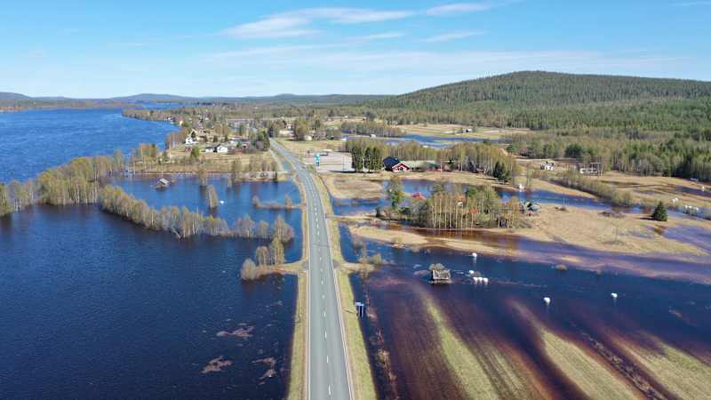
Flooding has become more difficult with climate change. According to researchers, floods can change even the season.
Changing climate affects river environments, and flood times have become unpredictable. The National Land Survey of Finland is involved in a study that shows that floods will also move from spring to other seasons.
– In Oulanka, the average temperature of the year has risen by more than three degrees Celsius in 50 years, and in December 7 degrees, Blåfield says in the release.
Information has been available at Könkä’s observation station since 1941 and from 1919 at the Marraskoski observation station. The most typical flood date on the Ounasjoki River is in mid-May.
Digital modeling anticipates the effects of floods
Researchers are now digitally collecting in Finland, which can help you better prepare for extreme weather phenomena. Research information also allows you to anticipate the behavior of rivers, for example, if it is suddenly raining.
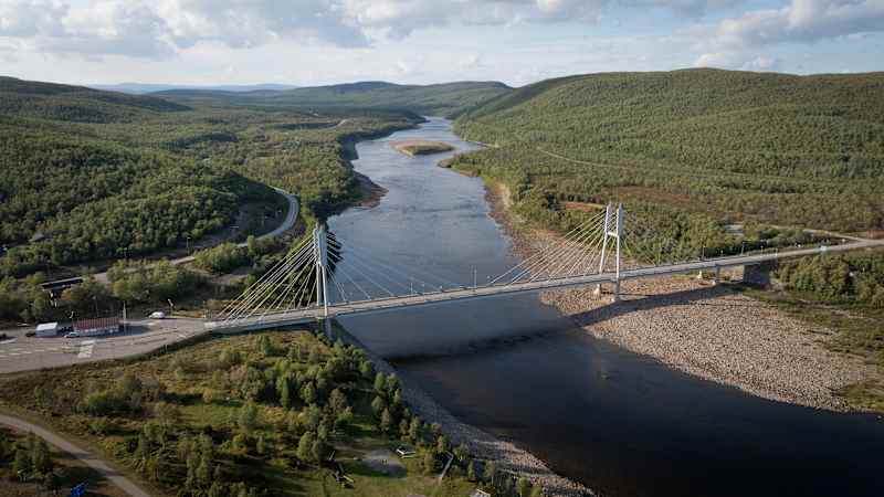
Measurements have been made with a mobile research equipment in the Vantaanjoki, the Oulankajoki and the Tenojoki and its tributary in Pulmankijoki.
– They are the first test sites, and we test different techniques in more detail, says Kaartinen.
– Nowadays, we are able to keep track of how the masses move, for example in the case of flood situations: how flood water moves sandbags or consumes sandwiches, says Kaartinen.
Kaartinen says, for example, that a couple of years ago, they measured the Tenojoki River with a long distance, a total of two hundred kilometers from the Karigasniemi to the Arctic Ocean.
– In the past, it has been impossible to make such a wide and accurate measurement in any area. Now the new 3D measurement techniques allow for extensive mapping.
As technology evolves measurements throughout Finland
According to Kaartinen, the greatest benefit of digital modeling is to provide up -to -date information on the actual situation of the flood and how the river behaves.
The comprehensive height model of the riverbed and the catchment area for measurements helps to detect erosion, ie ground wear and post-flood changes.
The measurements also monitor the solid ingredients that carry and stratify the water, the flow rate and direction of the water, and changes in the riverbed.
– With the help of the measurements, we know what kind of flows have been and how high the water has risen. After the flood, we are able to measure very precisely what changes it caused in the riverbed, says Kaartinen.
The study uses a lot of permanent measurement stations, such as a variety of water levels and flow gauges. According to Kaartinen, they, as well as video cameras, are able to monitor the behavior of the river in real time.
– As technology evolves, the measurements are to be expanded throughout the country, says Kaartinen.
In addition to the National Land Survey of Finland’s Geographic Information Center (FGI) and the University of Turku, the study includes Aalto University, the Finnish Environment Institute and the University of Oulu.